Iowa Road Trip Followers Share Their Favorite Places to See Fall Colors
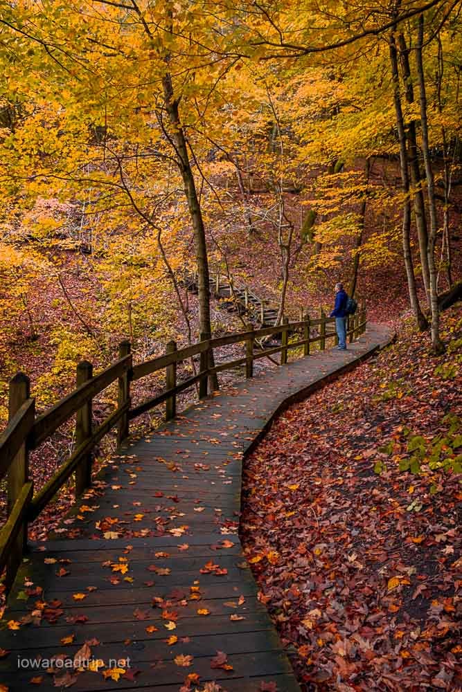
Ask Iowans where they go to see fall colors, and northeast Iowa usually dominates the conversation.
That was certainly the case when we asked Iowa Road Trip followers to name their favorite places to enjoy Iowa’s autumn scenery. We received roughly 150 responses, with frequent mentions of McGregor, Lansing, Decorah, Guttenberg and the Mississippi River.
The recommendations didn’t stop in northeast Iowa. Followers also named state parks, scenic drives, river valleys and small towns throughout the state.
Rather than ranking the responses, we organized them geographically. Use this guide to find fall-color destinations close to home or plan a longer road trip through another part of Iowa.
Northeast Iowa and the Mississippi River
Northeast Iowa received more recommendations than any other part of the state. Wooded bluffs, river overlooks, winding highways and small river towns make this the traditional center of Iowa’s fall-color season.
For more specific overlooks and photo locations, see our complete guide to the favorite places to catch fall colors in northeast Iowa.
McGregor, Marquette and Pikes Peak State Park
Start at: Pikes Peak State Park, 32264 Pikes Peak Road, McGregor, IA 52157 Website: Pikes Peak State Park
Pikes Peak State Park is one of Iowa’s best-known fall overlooks. The main viewing platform sits high above the confluence of the Wisconsin and Mississippi rivers, providing a wide view of the river valley and wooded bluffs.
The overlook is a short walk from the parking area. Additional trails lead through the woods to Bridal Veil Falls and other viewpoints, but expect stairs and uneven surfaces.
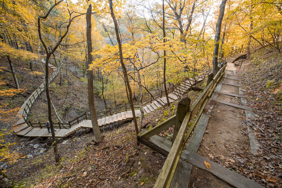
Continue into McGregor to explore the downtown area before crossing into Marquette. The Marquette scenic overlook adds another elevated view of the Mississippi River and makes an easy addition to the trip.
Pikes Peak can become crowded during peak fall weekends — arrive early for the best chance at parking and a quieter overlook.
Allamakee County
Start at: Driftless Area Education and Visitor Center, 1944 Columbus Road, Lansing, IA 52151 Website: Allamakee County Economic Development and Tourism
Allamakee County contains several of Iowa’s most frequently recommended fall-color destinations. Lansing makes a practical starting point, with Mississippi River scenery along the waterfront and elevated views from nearby Mount Hosmer.
A road leads to the top of Mount Hosmer, where short trails connect several overlooks. Beck Point and Strong Point look out over Lansing, the river and the surrounding bluffs.
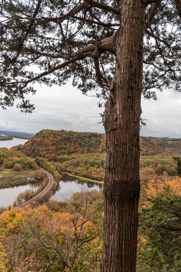
South of Lansing, Yellow River State Forest offers a more remote experience, with trails crossing rugged hardwood forest, valleys and streams. The Luster Heights Unit also has maintained trails leading to Mississippi River overlooks.
Effigy Mounds National Monument pairs fall scenery with one of Iowa’s most significant cultural landscapes. Trails climb through the forest to ancient American Indian mounds and elevated views above the river. Visitors should remain on designated trails and never walk on the mounds.
The Driftless Area Education and Visitor Center near Lansing rounds out the county with exhibits on the region’s geology, wildlife and natural history, plus its own view of the river valley.
These stops are spread across the county — pick two or three rather than trying to see all of them in one trip.
Decorah
Start at: Dunning’s Spring Park, 203 Quarry St., Decorah, IA 52101 Website: Visit Decorah
Decorah gives visitors several ways to experience fall color without depending on a single overlook.
Dunning’s Spring places a waterfall against a backdrop of changing leaves. Nearby Phelps Park sits above the Upper Iowa River, while Palisades Park provides elevated views from the other side of town.
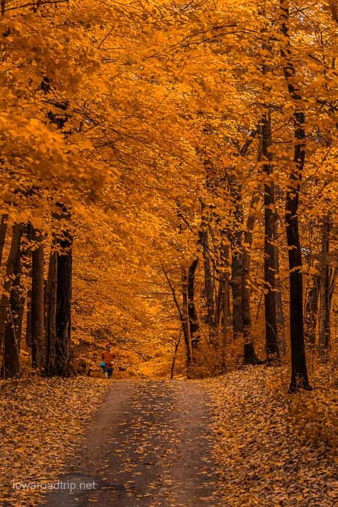
The Trout Run Trail circles the city and passes through woods, farmland and areas along the Upper Iowa River. You don’t have to complete the entire route — several access points make it easy to walk or bike a shorter section.
Restaurants, shops and other attractions make Decorah an easy place to turn a fall-color drive into a full-day trip.
Guttenberg, Balltown and the Great River Road
Start at: Guttenberg Riverfront, South River Park Drive, Guttenberg, IA 52052 Website: Great River Road National Scenic Byway
The drive into Guttenberg is part of the experience, with wooded bluffs rising above the Mississippi and several places to stop along the way.
The overlook near Highway 52 and Lorenz Lane provides a broad look across Guttenberg and the river valley. Down below, the riverfront offers another perspective, with color visible along the bluffs across the water.
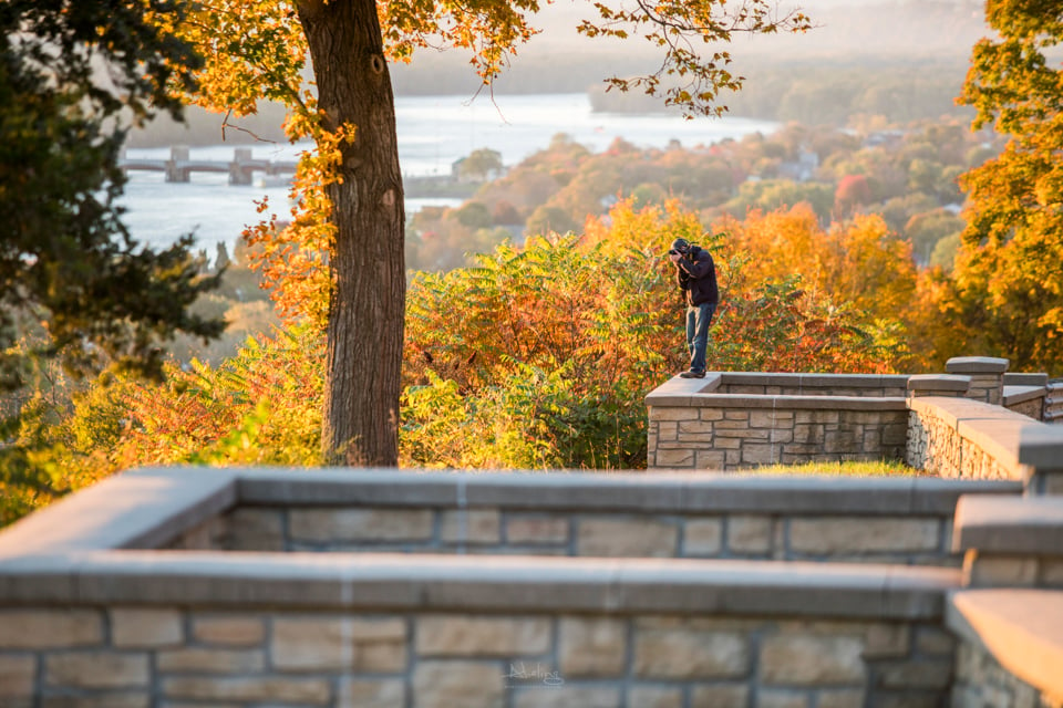
South of Guttenberg, follow the Great River Road toward Balltown. The winding drive climbs away from the river through wooded valleys and rolling farmland.
Balltown is home to Breitbach’s Country Dining, a popular meal stop on a northeast Iowa fall drive. Give yourself extra time for overlooks and unplanned stops — Highway 52 rewards a slow pace more than a direct one.
Backbone State Park
Address: 1347 129th St., Dundee, IA 52038 Website: Backbone State Park
Backbone State Park combines wooded trails, limestone formations and a lake surrounded by trees.
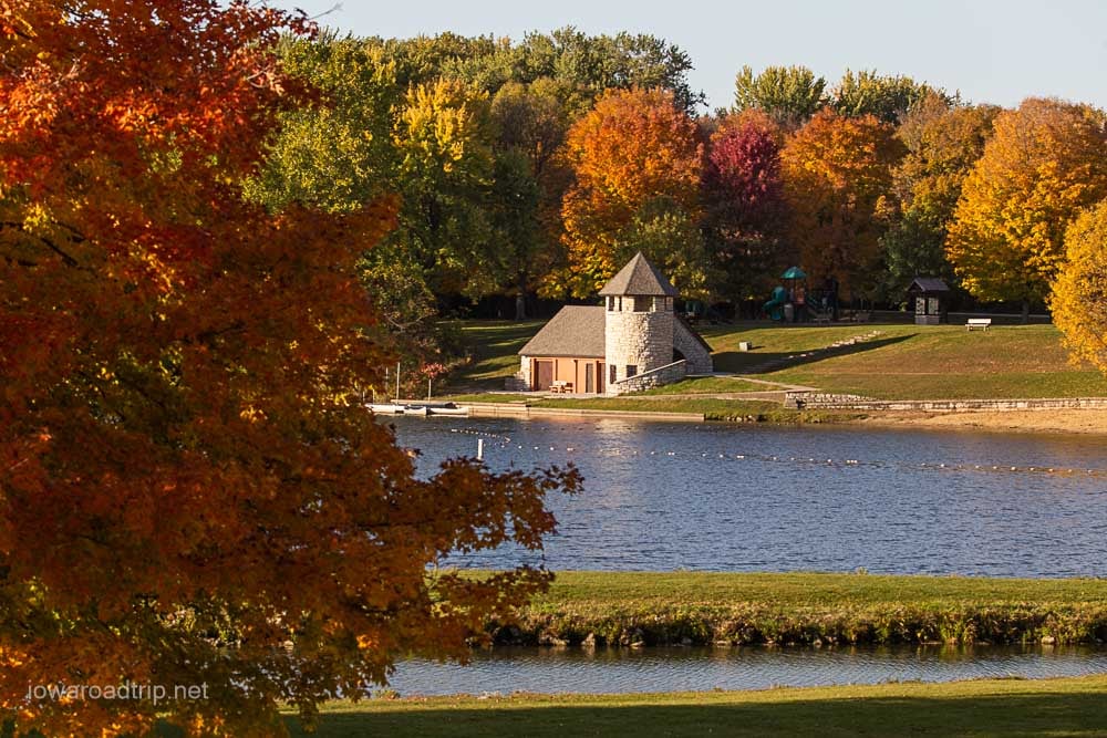
One easy starting point is the historic boathouse on Backbone Lake, where calm mornings can bring reflections of the surrounding color. For a more rugged hike, the Backbone Trail follows the narrow ridge that gave the park its name, with exposed rock and elevated views along the way.
Richmond Spring offers a quieter scene, with its spring and stonework tucked away from the park’s busier areas.
Dubuque, Mines of Spain and Swiss Valley
Start at: E.B. Lyons Interpretive Center, 8991 Bellevue Heights Road, Dubuque, IA 52003 Website: Mines of Spain Recreation Area
Dubuque pairs Mississippi River scenery with several parks and natural areas.
The Mines of Spain Recreation Area has trails through hardwood forest, restored prairie and bluff country. Julien Dubuque Monument is its most recognizable landmark and looks out across the river.
Eagle Point Park is another strong stop, with overlooks facing the river, Lock and Dam No. 11 and the wooded hills of Wisconsin.
Southwest of the city, Swiss Valley Nature Preserve offers a quieter hike along Catfish Creek — a good alternative to the more heavily visited river overlooks.
Central and North-Central Iowa
Central Iowa’s best fall destinations cluster around river valleys, wooded state parks and elevated viewpoints, several close enough to combine into a single day trip.
Ledges State Park and Rural Boone County
Address: 1515 P Ave., Madrid, IA 50156 Website: Ledges State Park
Ledges State Park is one of central Iowa’s most popular fall destinations. Peas Creek runs through a sandstone canyon surrounded by wooded hills, a setting unlike most other Iowa state parks.
The canyon road and creek crossings are the park’s most familiar features, but some of the best views are found above the canyon, where trails climb to overlooks over the Des Moines River valley.
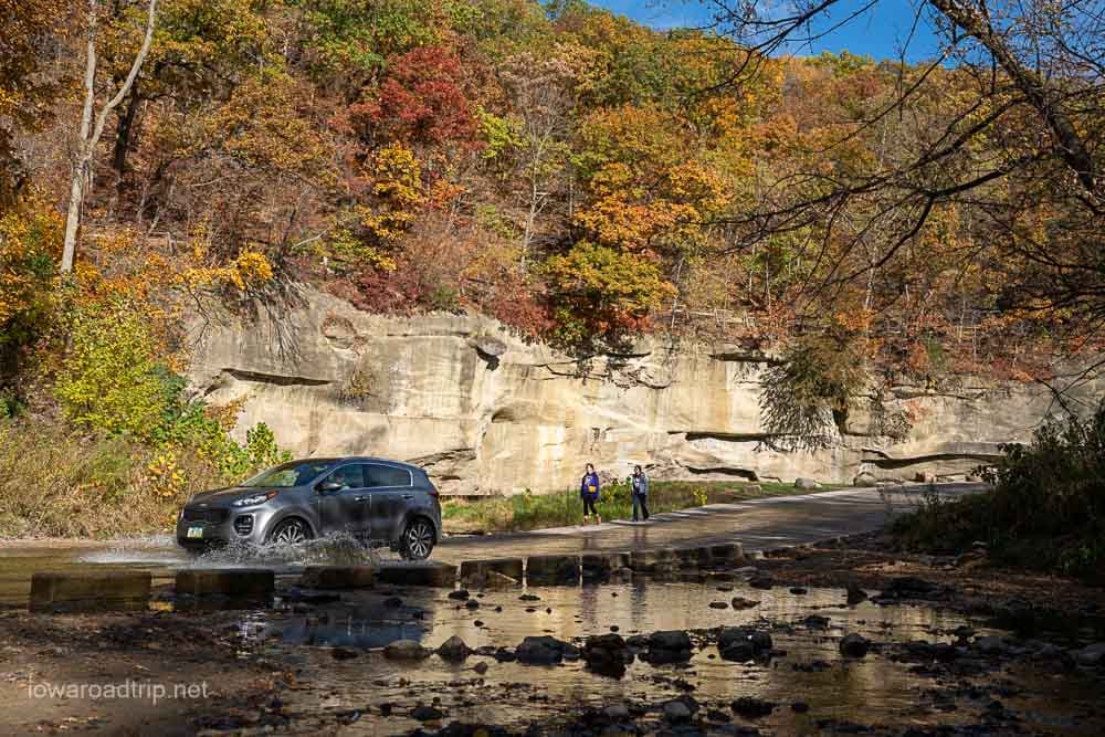
The rural roads around Boone and Madrid add farmland, wooded creeks and more river views. Fall weekends bring heavy traffic and can affect access to the canyon road, so check current park alerts and plan an early visit.
Dolliver Memorial State Park
Address: 2757 Dolliver Park Ave., Lehigh, IA 50557 Website: Dolliver Memorial State Park
Dolliver Memorial State Park follows the Des Moines River through wooded hills and sandstone formations.
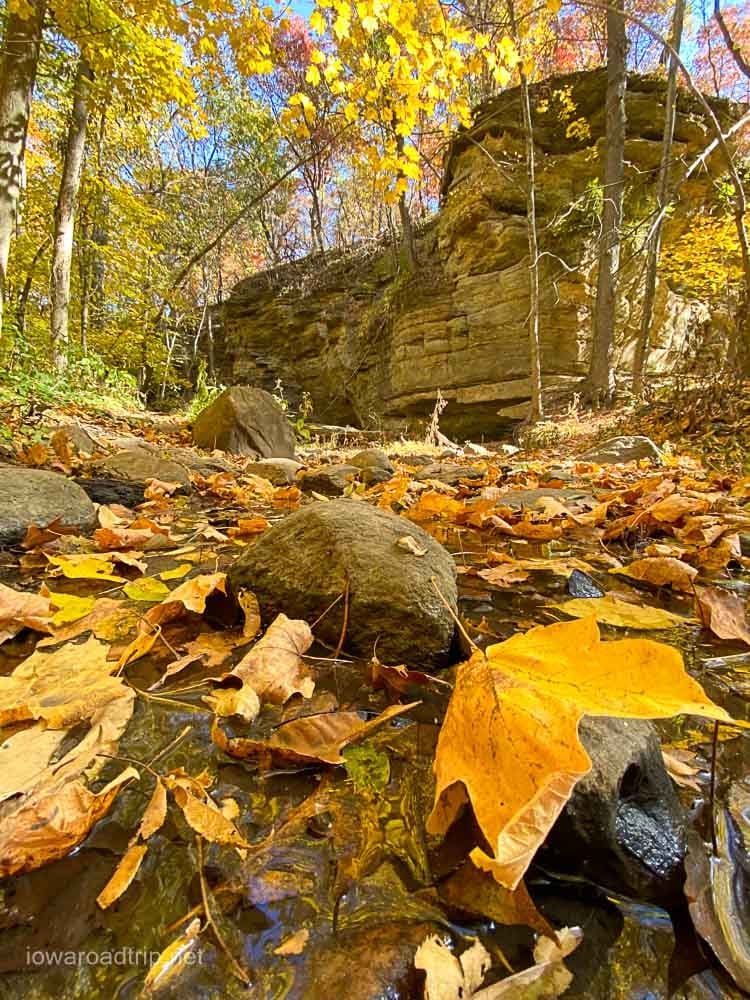
Boneyard Hollow is the park’s most distinctive area, where a trail follows a narrow ravine between sandstone walls with dense tree cover overhead. Other trails climb to higher ground for views across the river valley.
Stone and timber structures built by the Civilian Conservation Corps add another layer of interest for photographs. Dolliver is worth a look for visitors who enjoy Ledges but want a quieter stretch of the same river.
Pilot Knob State Park
Address: 2148 340th St., Forest City, IA 50436 Website: Pilot Knob State Park
The stone observation tower is the centerpiece of Pilot Knob State Park. Built on one of the highest points in the area, it provides a wide view of the surrounding countryside — a mix of woods, fields and distant farms that looks different from the river-valley overlooks found elsewhere in Iowa.
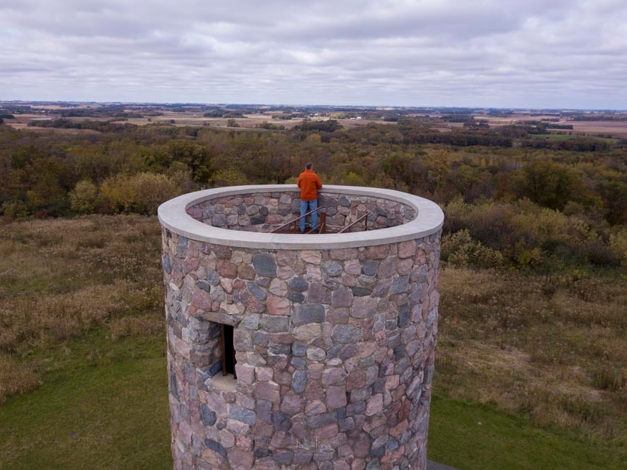
Trails connect the tower area with other parts of the park, including Dead Man’s Lake. The tower requires climbing stairs, but the park’s wooded roads and trails are open to anyone who’d rather stay at ground level.
Iowa Falls and the Iowa River Greenbelt
Start at: Assembly Park, 100 Rocksylvania Ave., Iowa Falls, IA 50126 Website: Iowa Falls Area Development Corporation
The Iowa River winds beneath limestone bluffs and tree-covered hills as it passes through Iowa Falls.
The swinging bridge is the town’s most recognizable fall attraction, offering a long look at the wooded banks on both sides of the river. Surrounding parks and trails add more views at river level.
The broader Iowa River Greenbelt extends beyond town and protects a scenic corridor along the river — some stretches are best explored on foot, others by car through Hardin County. It’s a solid pick for travelers who want fall scenery paired with a small-town stop.
Eastern Iowa
Eastern Iowa offers Cedar River bluffs, wooded trails, lake views and historic communities that can be combined into a flexible fall road trip.
Palisades-Kepler State Park, Coralville Lake and the Amana Colonies
Start at: Palisades-Kepler State Park, 700 Kepler Drive, Mount Vernon, IA 52314 Website: Palisades-Kepler State Park
Palisades-Kepler State Park sits along the Cedar River, with wooded trails leading to river overlooks and exposed rock formations. The park is relatively compact, but its elevation changes create several different views as trails follow the bluff and descend toward the water.
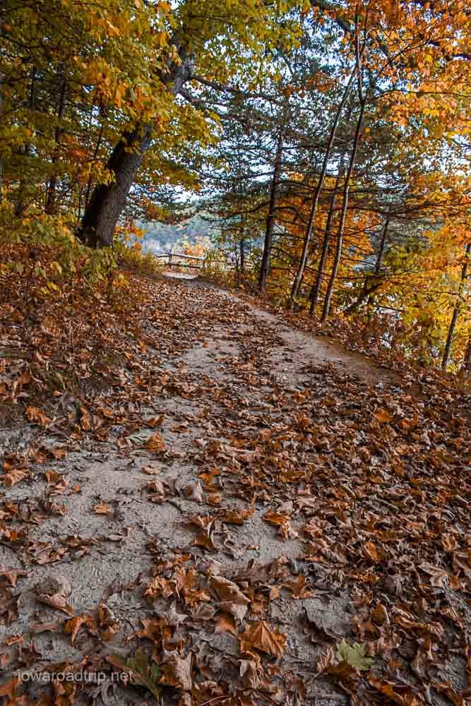
Coralville Lake adds more trails and overlooks northwest of Iowa City, and the drive can continue from there to the Amana Colonies, where historic buildings, shops and restaurants make a natural end to the day.
These stops don’t need to be a single route — pick one or two depending on whether you’d rather hike, photograph overlooks or explore a historic town.
Western and West-Central Iowa
Western Iowa’s fall landscape looks different from the heavily forested bluffs along the Mississippi River. Here, autumn color mixes with golden prairie grasses, wooded valleys and the deeply carved ridges of the Loess Hills.
Loess Hills Scenic Byway and Preparation Canyon State Park
Start at: Preparation Canyon State Park, 340th St., Moorhead, IA 51558 Website: Preparation Canyon State Park
Preparation Canyon State Park has hiking trails, picnic areas and one of the Loess Hills region’s best-known scenic overlooks. The landscape combines prairie-covered ridges, wooded valleys and long views toward the Missouri River valley, with late-afternoon light bringing out the texture of the hills and the warmth of the prairie grasses.
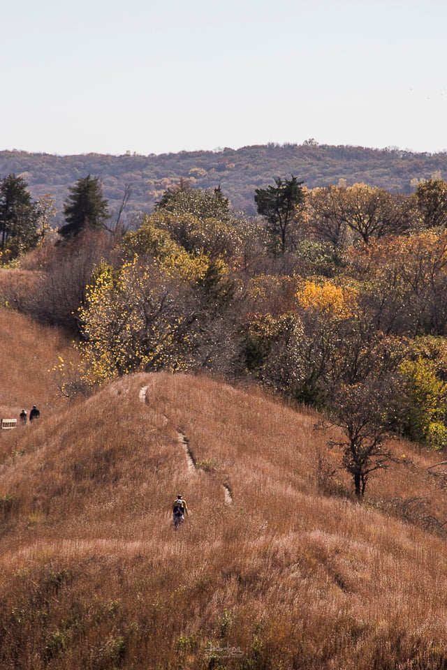
The Loess Hills National Scenic Byway connects Preparation Canyon with other public areas and small communities. Some of the best views require leaving the main highway, so budget more time than the mileage suggests.
Waubonsie State Park
Address: 2585 Waubonsie Park Road, Hamburg, IA 51640 Website: Waubonsie State Park
Waubonsie State Park brings together two types of fall scenery: open prairie ridges and shaded woodland valleys filled with changing leaves.
The park’s elevated viewpoints look west across the Missouri River valley toward the Nebraska plains. Sunset Ridge is a good choice for hikers seeking broad views of the Loess Hills.
Waubonsie has several miles of trails for hikers, mountain bikers and horseback riders — check the trail map first, since permitted uses vary by trail. Its location near Hamburg makes it one of the best fall-color destinations in Iowa’s far southwest corner.
Stone State Park and the Northern Loess Hills
Address: 5001 Talbot Road, Sioux City, IA 51103 Website: Stone State Park
Stone State Park sits along the northern end of the Loess Hills, offering wooded ravines, prairie ridges and overlooks near Sioux City. Trails climb through terrain that can feel surprisingly rugged for a park so close to an urban area, with higher points looking across the Big Sioux and Missouri river valleys and lower trails passing beneath a canopy of changing leaves.
It’s a practical choice for travelers in northwest Iowa, and can also serve as the northern starting point for a longer drive along the Loess Hills National Scenic Byway.
Iowa Great Lakes and Fort Defiance State Park
Start at: Fort Defiance State Park, 1730 360th Ave., Estherville, IA 51334 Website: Fort Defiance State Park
Fort Defiance State Park protects nearly 200 acres of rugged woodland on the edge of Estherville. Its mature trees and rolling trails make it one of northwest Iowa’s stronger options for a traditional walk beneath fall foliage.
The trail system crosses wooded hills and areas of prairie, with some routes running steep or uneven; the roads and picnic areas offer easier ways to enjoy the setting.
Fort Defiance pairs well with a drive through the Iowa Great Lakes region — routes around Spirit Lake, West Okoboji Lake and Arnolds Park add lakeside color, parks and small-town stops. Northwest Iowa’s trees may change earlier than the rest of the state, so check current color reports before planning the trip.
Mahanay Memorial Carillon Tower and Jefferson
Address: 100 E. Lincoln Way, Jefferson, IA 50129 Website: Mahanay Memorial Carillon Tower
The Mahanay Memorial Carillon Tower offers a different way to see Iowa’s fall colors. An elevator carries visitors to an enclosed observation deck roughly 120 feet above downtown Jefferson, with views across the city and surrounding countryside in several directions — the historic courthouse square, rooftop art, nearby murals and a broad patchwork of trees and farmland.
The tower’s public schedule extends into fall, but October hours may be limited to weekends, so check before making a special trip. Jefferson sits along the historic Lincoln Highway, making the tower an easy stop during a longer drive through west-central Iowa.
Southern and South-Central Iowa
Southern Iowa’s color often develops later than it does in the northern part of the state. Wooded river valleys, rolling countryside, lakes and historic structures provide plenty of reasons to plan a late-October drive.
Winterset and the Madison County Covered Bridges
Start at: Madison County Chamber of Commerce, 73 Jefferson St., Winterset, IA 50273 Website: Explore Madison County
Madison County combines fall color with one of Iowa’s most recognizable collections of historic structures.
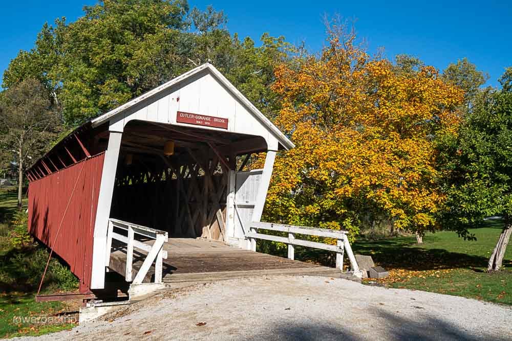
Six covered bridges remain in the county, spread across several locations, making a visit to all of them a scenic driving route through wooded areas and rolling farmland. Cedar Bridge and Hogback Bridge are among the most photographed, but each has its own setting — some close to maintained roads and parking, others more secluded.
Clark Tower in Winterset City Park is another strong stop, its stone structure standing among the trees with elevated views across the countryside. Highway 169 between Interstate 80 and Winterset is also worth watching for color, and Corkscrew Hill near Dexter adds a winding, wooded stretch to the drive.
Download a current covered bridge map before starting. Cellular service can be spotty on the rural roads here, and a planned route will save you from backtracking.
Lake Red Rock
Start at: Cordova Park, 1378 Highway G28, Otley, IA 50214 Website: Lake Red Rock
Lake Red Rock combines wooded shoreline, high bluffs, trails and broad views across Iowa’s largest lake.
The observation tower at Cordova Park is one of the best-known viewpoints — the climb involves numerous stairs, but rewards visitors with a panoramic look across the lake and surrounding countryside. The park also has lake views available from ground level for those who’d rather skip the tower.
Other options around the lake include the Volksweg Trail, South Overlook and trails near the Red Rock Dam, though the recreation area is large enough that these spots can be several miles apart. Combine a visit with stops in Pella or Knoxville rather than trying to circle the entire lake in one trip.
Southeast Iowa
Southeast Iowa’s strongest fall color may arrive later than it does in the northern part of the state. The region combines wooded river valleys, lakes, historic villages and quieter stretches of the Mississippi River.
Van Buren County, Lacey-Keosauqua State Park and Lake Sugema
Start at: Lacey-Keosauqua State Park, 22895 Lacey Trail, Keosauqua, IA 52565 Website: Villages of Van Buren County
Lacey-Keosauqua State Park overlooks a bend in the Des Moines River and contains miles of wooded trails, with roads, overlooks and historic Civilian Conservation Corps structures offering several ways to take in the scenery without a long hike.
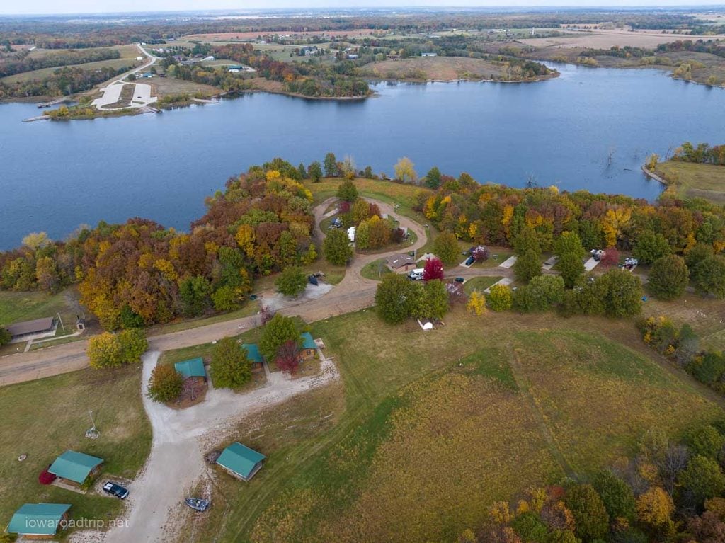
A few miles away, Lake Sugema adds lakeside views and opportunities for hiking, birdwatching and wildlife photography, surrounded by the Lake Sugema Wildlife Area and Indian Creek Wildlife Area for a much larger natural setting than the developed recreation area alone.
These stops pair naturally with a drive through Keosauqua, Bentonsport, Bonaparte and Farmington, where river views, historic buildings and wooded hills appear throughout the county. Leave room in your schedule for river access points and gravel roads rather than rushing from town to town.
Geode State Park
Address: 3333 Racine Ave., Danville, IA 52623 Website: Geode State Park
Geode State Park surrounds Lake Geode in southeast Iowa. Wooded trails follow portions of the lakeshore and climb to higher ground overlooking the water.
The main trail begins near the north end of the lake and continues toward the dam, while another trail follows the western side, allowing hikers to connect sections for a longer loop. Shorter out-and-back walks work well for those who’d rather skip the full route — either way, it’s a solid choice for fall color paired with lake reflections.
The Mississippi River Road Between Keokuk and Montrose
Start at: Rand Park, 1300 Grand Ave., Keokuk, IA 52632 Website: Iowa Great River Road
The stretch of the Great River Road between Keokuk and Montrose follows the Mississippi River through Iowa’s far southeast corner.
Begin at Rand Park in Keokuk, where the Grand Army of the Republic Memorial area gives an elevated view toward the river, then follow the river north toward Montrose. Stops near Montrose look across the Mississippi toward Nauvoo, Illinois — the river is wider here than in many parts of northeast Iowa, creating a different kind of fall landscape.
This drive is especially appealing near sunset, when the low light reaches across the water. Combine it with Keokuk’s riverfront, Lock and Dam No. 19 or other stops in Lee County.
More Places Recommended by Iowa Road Trip Followers
The discussion produced more worthy suggestions than we could feature in detail. Other recommendations included:
- Bellevue State Park, Bellevue
- Elkader and the Turkey River
- Eagle Point Park, Clinton
- Grant Wood Scenic Byway, eastern Iowa
- Oakland Mills, Mount Pleasant
- Hartman Reserve Nature Center, Cedar Falls
- Lake Okoboji, northwest Iowa
- Lake of Three Fires State Park, Bedford
- Prairie Rose State Park, Harlan
- Lake Anita State Park, Anita
- Nine Eagles State Park, Davis City
Tips for Planning an Iowa Fall-Color Road Trip
Check the forecast before leaving, especially if your plans include hiking. Rain can make fallen leaves, stairs and rocky trails slippery, and strong winds can quickly strip leaves from trees that have reached their peak.
Weekdays and early mornings are generally quieter than weekend afternoons — popular destinations such as Pikes Peak, Mount Hosmer and Ledges can get crowded during peak color.
Bring layers. Temperatures can swing considerably between morning and afternoon, particularly at exposed overlooks.
Check official park websites for trail closures, road construction and facility schedules. Some state forests and wildlife areas permit hunting, so wearing blaze orange is a sensible precaution during hunting seasons.
Most importantly, don’t focus entirely on reaching peak color. Some of the best scenes appear when green, yellow, orange and red leaves are visible at the same time.
What Is Your Favorite?
Did your favorite Iowa fall-color destination make the guide? Leave a comment with the park, trail, overlook or scenic drive you return to each autumn. Your recommendation might become part of a future Iowa Road Trip adventure.