I had spent the night in Denison, Iowa, and was planning an early morning trip to Sioux City. When I woke up, there was a generous cover of frost on everything in Denison. It was still dark at the time, so I headed on my trip, hoping to be out in the frost when the sun would hit the horizon. If you’ve seen my photos before, you know that I love to photograph frost against blue skies.
My first stop was at Morgan Township Cemetery just south of Schleswig, Iowa. The sun was still down and the landscape was still covered with fog. As I headed wast on E16 from Schleswig towards Mapleton, the sun reached the horizon. This farmstead near Mapleton was covered with frost as the sun came up. Closeup of the frost covering a fence post along E16 in Monona County. Windmill along E16 near Mapleton, Iowa. As I got closer to Mapleton, I spotted this fence that was completely covered with thick frost. Even dead weeds show unique details when covered with frost. Treetops covered in fresh white frost again dark blue skies. This century old metal sided barn was recently destroyed in a strong wind storm in Dec 21 – but this frost scene was taken prior to that date. It was located east of Hornick, Iowa.Scenes along Hancock Avenue, east of Hornick, Iowa. A frosty scene between Sloan and Hornick, Iowa.
Overall Rating: 3/5 stars Google map location Length:. 0.9 miles Sidewalls: There are two sections with high sidewalls Hills: Nothing dramatic S-Curves: Only a few…
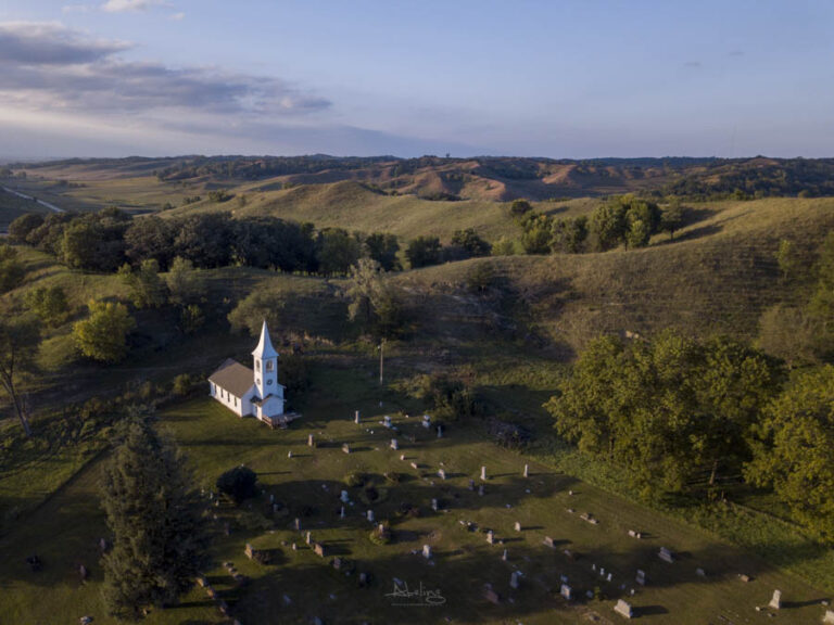
Some road trip stops speak quietly yet powerfully about the people who helped build the heartland. Ingemann Danish Lutheran Church — nestled in the serene…
Overall Rating: 3/5 stars Google map location Length: 1.39 miles miles Sidewalls: Yes, there are a few sections where the sidewalls are taller than your…
Overall Rating: 3/5 stars Google map location Length: 0.38 miles Although it’s short in distance, its still a very nice backroad because of the sidewalls…
Overall Rating: 3/5 stars Google map location Length:. 1.22 miles Sidewalls: Yes, there are several sections of tall sidewalls. Hills: Yes S-Curves: No major curves …
Aw, this was an extremely nice post. Spending some time and actual effort to generate a top notch article… but what can I say… I put things off a lot and never manage to get anything done.


Aw, this was an extremely nice post. Spending some time and actual effort to generate a top notch article… but what can I say… I put things off a lot and never manage to get anything done.